


Trade deal: How Trump team left Pakistan red-faced with map of India
AS New Delhi and Washington announced the framework for an interim trade agreement on Saturday, a map of India shared by the Trump administration quietly took centre stage, garnering attention on social media.
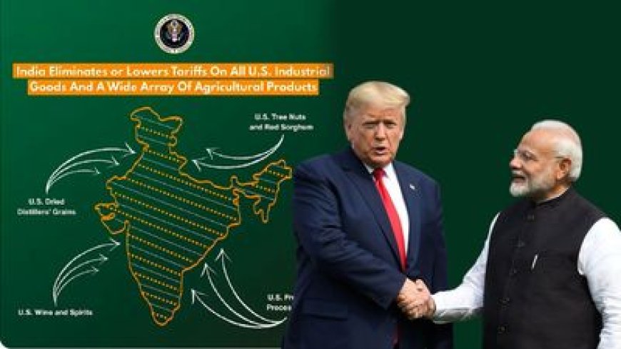
While releasing the trade deal details, the US trade representative's office released a map of India showing the entire Jammu and Kashmir, including Pakistan-occupied Kashmir (POK), as part of the country. Moreover, the map also included Aksai Chin, which China claims to be part of its territory.
However, it's not that the validation of India's territorial sovereignty required US approval. India has always maintained that Kashmir was an inalienable part of the country. But, still, it marks a departure from the US's earlier stance. Whether deliberate or incidental, it has sent a strong diplomatic signal to Pakistan -- that the US leadership is in line with India's map.
WHY THE US MAP OF INDIA MATTERS?
On previous occasions, the maps released by the US or its State Department used to have a clear demarcation of the POK, in line with Pakistan's concerns. It used However, the latest map released by the Trump administration clearly thumbs nose at Pakistan's claims.
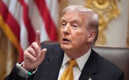
The timing is also crucial, as India and the US reset their ties under a mercurial Trump, following a turbulent period. Amid the trade deal deadlock, Trump slapped India with 50% tariffs -- the highest among the US's allies. Under the trade deal, it has now been slashed to just 18% -- the lowest among Asian nations.
Moreover, Trump also sought to re-hyphenate India and Pakistan, reversing the de-hyphenation policy started by the George W Bush administration and followed by subsequent presidents.
Moreover, the map also shows the disputed Aksai Chin region, located in the northeastern part of Ladakh, as part of India. China has always laid claim to the disputed land, ignoring India's objections.
In fact, the Ministry of External Affairs (MEA) has consistently objected to the incorrect depiction of India's borders -- specifically Jammu and Kashmir and Arunachal Pradesh -- on maps used by the US State Department and other global agencies. The US's latest move finally takes into consideration India's longstanding concern.
HOW EXPERTS REACTED TO US MAP DIPLOMACY?
Geopolitical experts and defence analysts were quick to praise the US move. "Full marks (to the US) for the map, though. Well done," tweeted Major Gaurav Arya (retired).
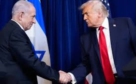
Another user posted, "A big hit to Pakistan, (Asim) Munir and all those Washington visits propaganda", referring to Islamabad's over-the-top flattery of Trump to curry favour with the White House.
Over the past six months, Pakistani diplomacy has been on overdrive, with its army chief, Asim Munir, visiting the US three times. He has also held two meetings with Trump, including a much-publicised lunch in June. It marked the first time a US President engaged Pakistan's army chief alone, without any civilian leadership present.
"Trade and all is secondary. This map is a departure from the US stand showing POK as part of Pakistan!" a journalist tweeted.
Nevertheless, the interim trade pact, which is likely to be signed in mid-March, brings long-awaited relief for India's exporters after a punitive 50% tariffs. India has also managed to secure concessions on steel, aluminium, copper, pharma, cars and car parts while maintaining its red lines on agriculture and dairy.
Now, whether the map marks a subtle shift in US policy by tilting towards India remains to be seen. Whether it is a tactical gesture aimed at placating India after a year of friction with Trump, or merely a bureaucratic oversight, remains open to interpretation.
What is clear, however, is that the map has given India significant bragging rights. It reinforces India's claims on its most sensitive territorial issues.